Case study of of the dam of Pramoritsa
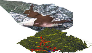
Title: Study of the protection, management and development of the naturel and residential environment of the dam of Pramoritsa Funding: Perfecture of Kozani Aim: Create a network of control points using GPS and production photogrammetry background, ie the Digital Terrain Model (DTM), and the orthophoto (land use and road, vegetation-land[…]
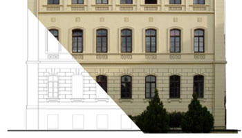
» » » »Earthquake 1978 Thessaloniki and Fire

Project for Earthquake 1978 – Fire of Thessaloniki Study area of Historical center of Thessaloniki. Photogrammetric methods were attributed to the roofs and terraces of buildings to create three-dimensional solid buildings.
» » » »Galerios Arch in Thessaloniki
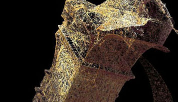
Laser Scanner use for data processing of the Galerios Arch in Thessaloniki The arch or triumphal arch of Galerius, known today as “Kamara”. It is in its original form of an eight gate with four massive central pillars, 4 the secondary side, and as many bows low spheroidal dome. Nowadays two[…]
» » » »3D Mapping of the historical building on AUTH Campus
Ski Resort – Seli

Recording and Mapping of Ski Resort
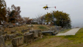
» » » »RC – Helicopter: 3D mapping of archaeological site of Vergina
3D mapping of the Roussanou Monastery, Meteora
Title: 3D mapping Roussanou Monastery, Meteora Trikala Greece Description: The abbey of Roussanou in Meteora, perfecture of Trikala is a protected monument of UNESCO world heritage since 1988. The aim of the surveying of the Roussanou monastery , was a remote assemply of colored 3D point cloud, which derived from Laser scanner’s[…]
» » » »Tempe Valley – Risk management – 3D Photogrammetric Mapping

Title: Three-dimensional photogrammetric mapping eastern slope valley Tempe Funding: Egnatia Odos SA Objective: The depiction of terrain model of the region of the rocks of Tempe, which formed the basis for investigating the causes of accidents. Imprinting the slope in approximately 4 km, with an accuracy of better than 50[…]
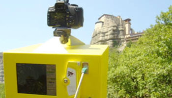
» » » »Documentation of the Historical rail way of Pilio
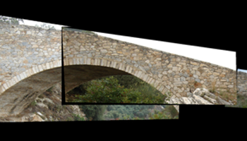
Identification of major technical works, bridges and network stations Photographic documentation and finding relevant information, historical and technical interest Impression and rendering of the Kouklakis arch-stone walkway at Ano Gatzea and the Taxiarchis Bridge Distribution, use and utilization of the Volos OSE technical service file
» » » »eMMCA – Virtual Macedonian Museum of Contemporary Art
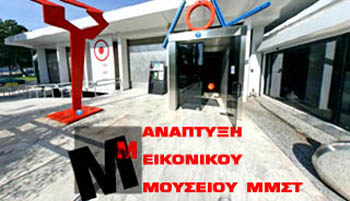
Title: Development of the virtual museum of MMCA (Museum of Contemporary Art, Thessaloniki, Greece) The virtual museum is accessible via the internet by providing a collection of digital objects that are logically connected to each other and reproduce traditional communication and inter-activity methods with the guests according to their needs[…]
» » » »