Planning of water pipe of Chalastra with satellite imagery and GPS
Title: Planning of water pipe of Chalastra with satellite imagery and GPS
Funding: Municipality of Chalastra
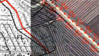
Objective: Measurements with GPS receivers at locations selected on the surface of modern satellite images Ikonos-2, for the production of Digital Monteleou soil, ortho-photo-mosaic satellite images and orthophotos in EGSA ’87.
Supply of satellite images of the region of interest. Measurements points with GPS, Creating DTM, measurement control points, digital processing of satellite images, Geo-reference Orthoimagery Production, Use DTM, conductor position coordinates, ortho-photo-mosaic scale 1: 5,000 with contour of curves from IKONOS satellite images.