Egnatia Highway Project
Τitle: A case study of land changes in EGNATIA highway
Funding: EGNATIA ODOS A.E.
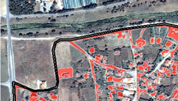
Aim: The purpose of this study is to investigate at a pilot stage the land cover changes occurring in selected areas under direct influence of the ‘Egnatia’ highway. This is accomplished with the estimation of two specific impact indicators.
The first indicator monitors the pressure for land use changes that have occurred over the decade 1998-2007 by estimating: the rate of change of agricultural land (cultivated areas) into urban land, the change of natural areas into urban land, and the change of natural areas into agricultural land.
The second indicator monitors the changes in residential areas for the same period of time, by estimating the rate of change of the urban’s land density, based on three categories: continuous, linear and discontinuous urban land. Data: three multispectral SPOT orthoimages, with spatial analysis 20m, three synthetic images IKONOS, with spatial analysis 1m, three corresponding DTMs with grid size 25m, the established borders of the Greek Settlements in vector format.