3D Laser Scanner
Mobile Mapping system

How it works A complete solution for data collection with the laser data acquisition method, the photogrammetric 3D and data processing with stereoscopic 3D GIS interface for fast data collection. The system uses the latest laser scanner technology, cameras, odometer, inertial and satellite navigation. It is a very quick and[…]
» » » »3D Mapping of the Church of Protaton, Mount Athos

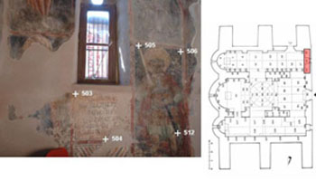
Title: Photogrammetric mapping murals Protaton karyes Funding: KEDAK Objective: The problem of photogrammetric surveying of the murals of Protaton Karyes Mount Athos was very complex and in large scale. The extent of the surface to fix it was more than 600 m2 and it took over 4000 of control points, which[…]
» » » »3D Laser Scanner – Cyclops Polifemus Cave, Maroneia
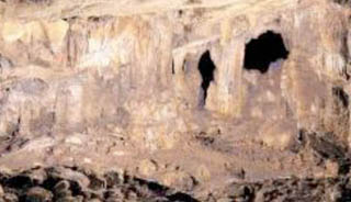
The choice of Cyclops Polifemus Cave was based on its historical significance as according to archaeologists there is evidence of its use since prehistoric times. The myth under stories is telling that Polyphemus’s blindness caused by Odysseus. Cyclops Cave is located in the prefecture of Rodopi at municipality of Maroneia.[…]
» » » »Galerios Arch in Thessaloniki
Laser Scanner use for data processing of the Galerios Arch in Thessaloniki The arch or triumphal arch of Galerius, known today as “Kamara”. It is in its original form of an eight gate with four massive central pillars, 4 the secondary side, and as many bows low spheroidal dome. Nowadays two[…]
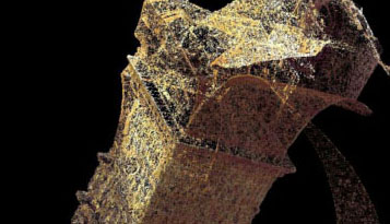
» » » »3D mapping of the Roussanou Monastery, Meteora
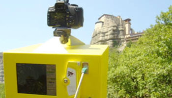
Title: 3D mapping Roussanou Monastery, Meteora Trikala Greece Description: The abbey of Roussanou in Meteora, perfecture of Trikala is a protected monument of UNESCO world heritage since 1988. The aim of the surveying of the Roussanou monastery , was a remote assemply of colored 3D point cloud, which derived from Laser scanner’s[…]
» » » »Tempe Valley – Risk management – 3D Photogrammetric Mapping

Title: Three-dimensional photogrammetric mapping eastern slope valley Tempe Funding: Egnatia Odos SA Objective: The depiction of terrain model of the region of the rocks of Tempe, which formed the basis for investigating the causes of accidents. Imprinting the slope in approximately 4 km, with an accuracy of better than 50[…]
» » » »eMMCA – Virtual Macedonian Museum of Contemporary Art
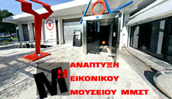
Title: Development of the virtual museum of MMCA (Museum of Contemporary Art, Thessaloniki, Greece) The virtual museum is accessible via the internet by providing a collection of digital objects that are logically connected to each other and reproduce traditional communication and inter-activity methods with the guests according to their needs[…]
» » » »3D Mapping of the church of Panagia Kera, Crete
Title: 3D Mapping presentation of the church Panagia Kera in Kritsa, Agios Nikolaos, Crete Objective: The three-aisled vaulted domed church of Panagia Kera in Crete is dedicated to the Assumption. The temple was gradually built. Originally built in the nave of the church on the type of hall church with[…]
» » » »