Research
Photogrammetry
- Production of maps from aerial photographs.
- Analytical Photogrammetry, optimization, accuracy, reliability and software development.
- Photographic exposures with the use of high precision photogrammetric cameras.
- Use of high precision photogrammetric instrumentation for restitution purposes.
- Research on the use of amateur cameras to photogrammetric projects.
- Digital processing of satellite images for the updating of existing maps.
- Extraction of 3-D metric information from satellite imagery for the creation of topographic maps.
- Combination of photogrammetry and surveying for the mapping of buildings, monuments and archeological sites.
- Integrated Photogrammetry: use of digital images, photographs, plans and GIS structures for the updating of maps
Remote Sensing
- Analytical tools for digital filtering and classification procedures of images.
- Interpretation of photographs and images for the extraction of thematic information like land-use, geomorphology etc.
- Monitoring of the environmental pollution (atmosphere, water etc.) with the use of special photographs and satellite images. (mymancavestore.com)
- Damage assessment of natural disasters (fires, earthquakes etc.) and industrial accidents.
- Sea and coastal monitoring
- Application of Artificial Intelligence and Expert Systems to problems of Photogrammetry, Remote Sensing, GIS and Cartography.
- Development of data compression techniques for topographic, cartographic and remotely sensed information.
- Development of special graphics database for incorporation into GIS systems.
- MSS, TM και ETM+ satellite Landsat-1,2,3,5 & 7
- PAN (stereo), XS, XSIR and HRS (stereo) satellite SPOT-1,2,3,4 &5
- IRS-1C satellite IRS-1C
- P & MS QuickBird satellite QuickBird
- P & MS stereo image IKONOS-2 satellite IKONOS-2
- Kartosat-1 satellite Kartosat-1 (stereo)
- Hyperion satellite EO-1
 ENIGMA
 Triquerta
 Birn
Birn
 LIFE-EL-BIOS
 Smart Eye
 Smart-Tool
 DigiOrch
 Post-fire biodiversity and biotic natural capital recovery: Framework development in the case of Evia (Greece)
 LIFE IP-4 NATURA
 sustAGE
 DISHEAT
 MaiL
MaiL
 ENVIROLENS
 ELIDEK
 SAVEMEDCOASTS2
 DiAS – Disaster & Agriculture Sentinel Applications
 Harmonious
 SMURBS
 GeoEssential
 SaveMedCoasts
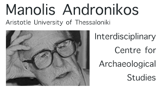 Manolis Andronikos Centre
 CIPA – Task Group 5
 HERITAG
 ERA-PLANET
 FORCIP+
 GEO Group on Earth Observations
 Baden Wuerttemberg Stipendium
 COST – iMHB
 Lara
Lara
 IASON
IASON
 EOPOWER
 SCOLIOSEE
 LOCAL – SATS
 Research Projects & Activities