I am pleased to announce that our paper regarding the computation of Indicator 11.7.1 was published in Remote Sensing this week!
Our paper was part of the Special Issue Artificial Intelligence and Earth Observation in Support of the UN Sustainable Development Goals and is entitled A Cloud-Based Mapping Approach Using Deep Learning and Very-High Spatial Resolution Earth Observation Data to Facilitate the SDG 11.7.1 Indicator Computation.
Check it out at: https://www.mdpi.com/2072-4292/14/4/1011
Citation:
Verde, N.; Patias, P.; Mallinis, G. A Cloud-Based Mapping Approach Using Deep Learning and Very-High Spatial Resolution Earth Observation Data to Facilitate the SDG 11.7.1 Indicator Computation. Remote Sens.2022, 14, 1011. https://doi.org/10.3390/rs14041011
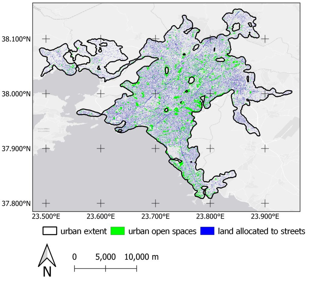
(LAS) and urban open spaces (UOS)
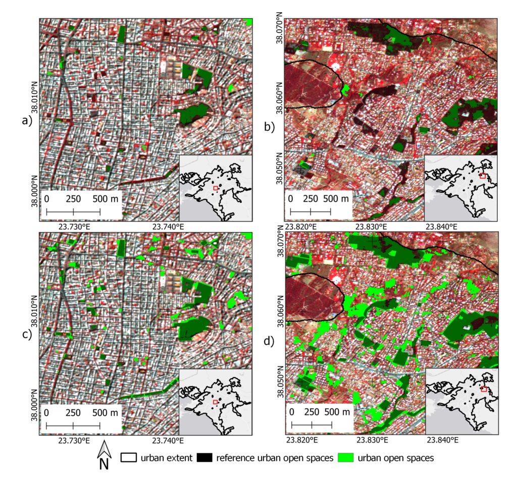
densely built‐up areas (a,c) and in green suburbs of the city (b,d).
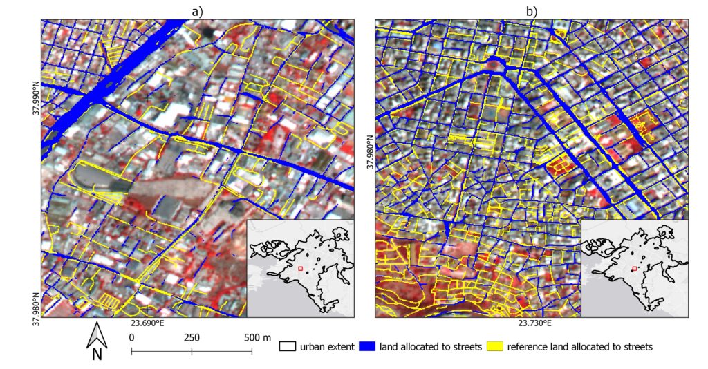
city (Plaka).