November2013
Mobile Mapping system
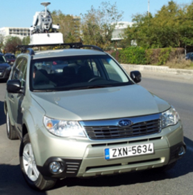
How it works A complete solution for data collection with the laser data acquisition method, the photogrammetric 3D and data processing with stereoscopic 3D GIS interface for fast data collection. The system uses the latest laser scanner technology, cameras, odometer, inertial and satellite navigation. It is a very quick and[…]
» » » »